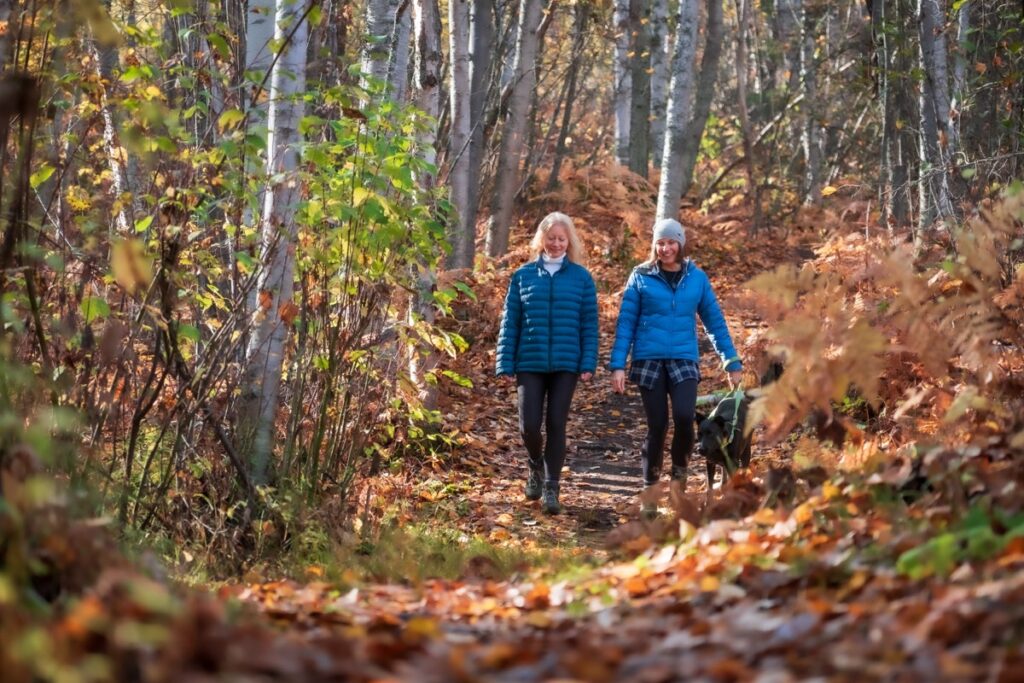
Castlegar is a hiking mecca! Whether you prefer long strolls beside the river or high alpine treks, this area of the West Kootenays in British Columbia has it all.
Part of the reason hiking is so good in Castlegar is because of the hard work done by such local non-profit organizations as the Kootenay Mountaineering Club, which was established way back in 1964, and the Castlegar Parks and Trails Society. The latter has raised close to $400,000 in the last five years alone and built and maintained bike and hiking trails, created signage and taken care of permits and land management. The group is also responsible for ensuring the Trans Canada trail wound it’s way through the community. It’s safe to say the CPTS, its volunteers and directors, have helped turn Castlegar into a hiker’s paradise since its establishment in 2001.
We list a number of the trails in and around the city on our Castlegar Hiking Trails page but we wanted to know more from an expert about which ones are better. So we caught up with Castlegar resident Doug Clark to ask what the best hiking trails in Castlegar are. He would know. He is a former president of the Kootenay Mountaineering Club and a past president of the CPTS and has hiked and ski toured all over the region. He says the West Kootenays, and specifically Castlegar, offer something for everyone, whether you’re a novice who wants to go on a casual stroll through the trees or a hardened trekker looking for a multi-day adventure.
Before starting any hike in the region, it’s a good idea to check the CPTS website for maps as well as the CPTS and KMC Facebook pages for updates on conditions. On the CPTS website you’ll find 18 trails ranging in difficulty from easy stroll to advanced trek and all starting points are within a 10-minute drive from downtown Castlegar. Doug says he’s done them all but when it comes to recommending a short, medium-length and long trail these are the three he says are the best hiking trails in Castlegar.
Dove Hill Trail
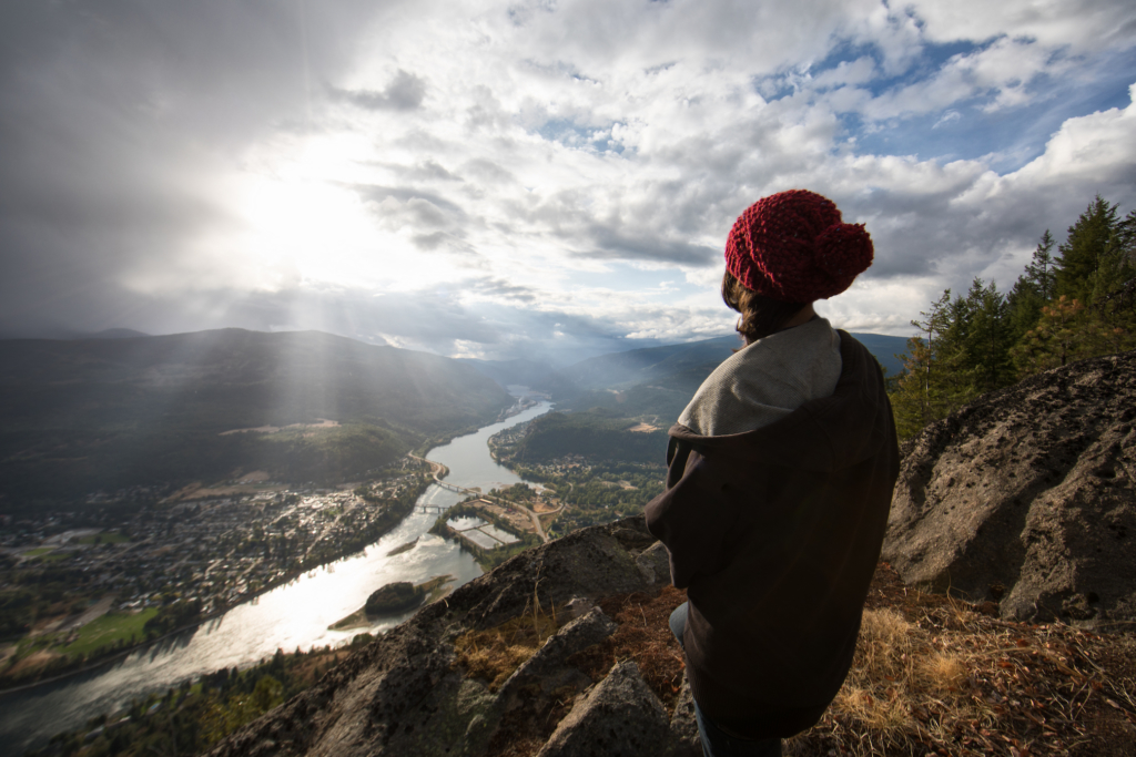
There are plenty of easy and short hikes in and around Castlegar. For example, paths wind their way though Millenium Park, past the river and various amenities that include a bike park and playground. And there’s the 1.5-kilometre Waldie Island Trail that passes through a protected Blue Heron bird sanctuary. But the trail that Doug says he always takes his out-of-town guests to is the Dove Hill Trail, because although it’s short, it offers excellent views of the confluence of the Kootenay and Columbia rivers. There are a few different variations of the trail but most people hike the 2.4-kilometre out-and-back from the power substation to the summit of Dove Hill and there’s only 160 metres of elevation gain. It should be noted this is also a popular area for tobogganing and families can be found here sliding down the slopes of Dove Hill throughout the winter.
Directions: Take Hwy 3a east out of Castlegar. Just past the airport, turn right onto Ootischenia Rd. Drive about 800 metres then turn left onto Columbia Rd and left again onto Aaron Rd. After the golf course gate, turn left onto a dirt road at the Dove Hill Trail sign. Park in the pull out on the left.
Brilliant Overlook Trail or Mel DeAnna Trail
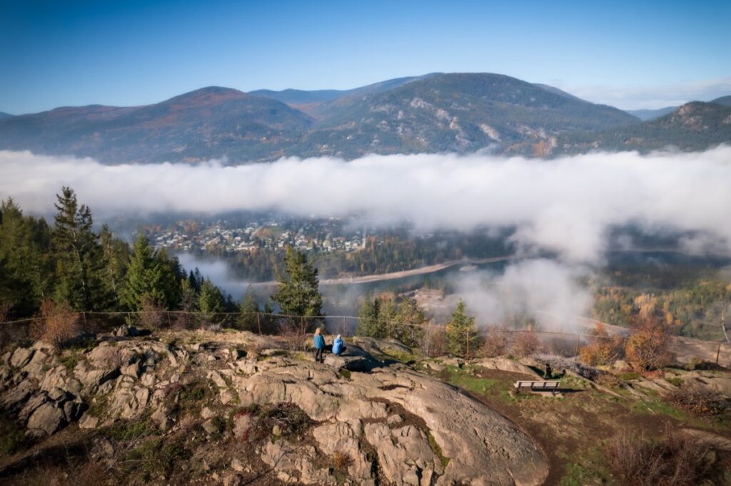
If you’re looking for a medium-length trail that will give your legs a good workout and treat you to some fantastic views, Doug says the Brilliant Overlook Trail is a must. Depending on your fitness level, this trail can take about four to five hours round-trip to the summit and back. There is about 350 metres worth of elevation gain so if you don’t like hiking uphill, consider sections of the Mel DeAnna, which is a flat trail that winds it’s way along the top of the cliffs overlooking the Columbia River. Both offer supreme views of Castlegar and the Columbia River but the Brilliant Overlook also offers views of Arrow Lakes and Robson. Interestingly, there is a multi-pitch rock climb that goes up the large face behind the substation at the Brilliant Trail. The nine-pitch sport climb is called “Megawatts” and is a relatively easy grade at 5.8. We detail it in our article, “The Best Rock Climbs in Castlegar.”
Directions: Take Hwy 3a east out of Castlegar. Just past the airport, turn right onto Ootischenia Rd. Drive about 800 metres then turn left onto Columbia Rd and left again onto Aaron Rd. Turn right on gravel road with the gate (McPhee FSR) and follow this for four kilometres, keeping left at the fork in road at two kilometres. Turn left into the parking lot before the substation. Follow the Skattebo Reach Trail on foot for one kilometre until you reach the trailhead on the right.
Columbia River Trail
The Columbia River Trail is a beautiful, relatively flat hike along the southern shore of the Columbia that connects Castlegar to Trail. It’s not a short one though. In fact, the entire trail stretches 18 or 25 kilometres one way, depending on where you start, so Doug says it’s best to do a vehicle drop at one end rather than hike it both ways. It passes through many different forest types, and offers plenty of scenic views of the communities and the river. Note that this trail is also open bicycles (non-motorized) and it is popular with them as there’s only 90 metres of elevation gain throughout the entire length of the trail.
Directions: There are two ways to access the Columbia River Trail. It’s a 25-kilometre one way trip to the water tower in Trail is you start at the end of Columbia Road in Ootischenia, near Castlegar. Alternatively, it’s an 18-kilometre trip if you start at the recently constructed picnic site 2 kilometres inside the Popoure gate.
Honourable Mention – The Sentinel Stomp
We also asked Doug if there was a favourite trail of his that didn’t fall under the maintenance umbrella of the CTPS and he mentioned one he affectionately calls the “Sentinel Stomp.” It’s not for the weak of knees though. The trail has approximately 1,600 metres worth of elevation gain. It starts at Verigins Tomb, which is another popular toboggan area in the winter time, and follows up the ridge of Mt. Sentinel, north of the city. Doug says the trail eventually connects with the Sentinel FSR and if you continue up that for about another hour, you’ll come upon the old site of the fire tower. Today there’s just the foundation left and a steel box which Doug thinks might have communications equipment in it. From that spot he confirms you can see the Bonningtons, the Norns and the Rossland ranges as well as the rivers, lakes and the city. It’s the closest hike to Castlegar that gets you high enough to see all the local mountains.
Directions: Start at the Verigin Memorial Park, 1850 Terrace Rd, and follow the trail to the Sentinel FSR, then continue up this for another hour to the old fire tower foundation.
For more information about other hiking trails in and around Castlegar, please visit our page Castlegar Hiking Trails.